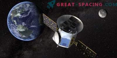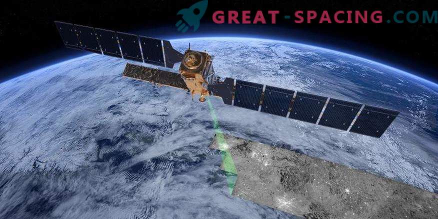
On March 30, 2017, NASA's Earth Observing-1 (EO-1) satellite retired after 16 years of service. He was part of the “New Millennium” program, which sought to test new technologies that would help reduce costs and improve the capabilities of future space missions. An enhanced Land Imager (ALI) device developed by the Lincoln Laboratory as an alternative to the ground-based imaging method used in the Landsat program was placed onboard the EO-1.
“ALI has demonstrated new technologies that can continuously monitor the Earth, winning in size, weight, power, and cost,” said Jeffrey Mendenhall, a member of the ALI development team. - “30 international research teams on agriculture have appreciated the various benefits of ALI: for agriculture and forestry, urban development, climate, volcanology, glaciology, geology, water management. All this was collected during the first year of work, while the effectiveness and functionality of the device was evaluated. According to the final conclusions, the ALI turned out to be better than Landsat 7 in many respects. ”
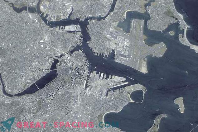
This panchromatic image of Boston is based on data collected during the scan on April 23, 2001.
ALI not only achieved a higher resolution and image quality, but also showed greater sensitivity and dynamic range. Moreover, compared to Landsat, ALI was smaller, lighter and consumed 5 times less energy, which favorably influenced the cost of the mission.
On November 21, 2000, the EO-1 satellite was launched as part of a one-year mission, whose goal is to collect 2,000 images of the Earth. Then its service life was extended by a year, and then by 5, since there was enough fuel for such a time period. However, the EO-1 exceeded all expectations. NASA, in collaboration with the US Geological Survey, the National Intelligence Agency, the Naval Research Laboratory, and the National Oceanic and Atmospheric Administration, operated the EO-1 for more than 15 years beyond its planned lifespan. During this time, we managed to accumulate more than 90000 images, many of which are innovative: displaying the lava flow from space and the first tracking of the restoration of the Amazon forest. There were also dramatic scenes: floods after Hurricane Katrina (2005), the eruption of the Momotombo volcano in Nicaragua (December 2015) and many others.
Lincoln Laboratories joined the project in January 1994. NASA asked for an inexpensive mission for a quick ground survey, as Landsat 6 failed the launch. The collected recommendations were not implemented immediately, but they became an excellent basis for the design and concept of the EO-1. In the spring of 1994, the Lincoln Laboratory began working with the NASA Goddard Space Flight Center.
The development of ALI was carried out strictly according to the schedule and it was necessary to redesign and re-examine the structure of the device to effectively support the optics and focal plane. NASA received its satellite in 1999. 5 days after the launch of the EO-1 in 2000, ALI made its first footage of the planet. They displayed a small town Sutton (Alaska), hiding in a dark valley.
Effect of ALI
ALI was designed as the best alternative to the Landsat 7 tool. For comparison, they were sent into orbit and received the same pictures. It turned out that the new satellite showed the same level of detail (30 m per pixel), but the image was much clearer.

November 25, 2000 - Sutton, Alaska (one of the first ALI shots).
The combination of ALI design solutions led to the creation of an innovative system that made it possible to abandon the scanning mirror and install large modular focal cavity arrays and optics with a wide field of view. To reduce the sensor's optical diameter and weight, the researchers increased the number of detectors in the array of the focal plane. Landsat had to focus on a specific area, and ALI collected data as it went along.
In addition, ALI used detectors from different materials, which made it possible to use several spectral ranges for complex visualization of objects and topography, and automated the ground data acquisition system to allow one operator to quickly receive and process data.
All new satellite then switched to Landsat 8, located in orbit since 2013. It collects data on terrestrial surfaces in the visible, near infrared and shortwave infrared.
Finally
When the satellite’s lifespan ended March 30, NASA stopped all moving parts, discharged the battery and turned off the transmitter. The device will continue to descend in orbit and in 39 years will burn in the atmosphere. In addition to valuable information for many scientific missions, EO-1 also managed to please with magnificent views of the home planet.


