Hyperspectral Imaging for Coastal Oceans (HICO) and Atmosphere and Ionosphere Remote Sensing System (RAIDS)
Images of Earth from space are not only beautiful and inspiring, but also provide valuable information for science and commerce that cannot be obtained in any other way. Experimental loading of HICO and RAIDS has received especially valuable images of a critical part of the planet - its coastal areas.
During the 5-year project on the ISS, it was possible to collect about 10,000 such frames, combining two experimental sensors HICO and RAIDS. Scientists used these images to estimate the concentration of healthy and harmful phytoplankton, determine harmful algal blooms in drinking water reservoirs, and assess water quality. HICO also participated in the planning and implementation of humanitarian relief operations. In addition, engaged in the identification of oil spilled due to gaps in the pipelines.
HICO's ability to observe coastal oceans is crucial to planetary needs. Hyperspectral surveys provide more information about the environment than ordinary imagery.

Image from HICO showing algae bloom on Lake Erie (Ohio) in 2011
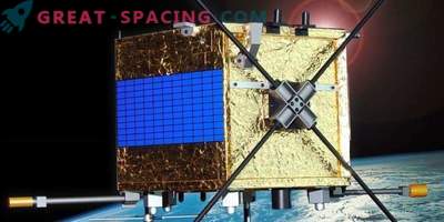
In 2009, HICO was installed on the outside of the Japanese experimental module (JEM-EF). The unique space orbit opens up a view that differs from traditional satellites, allowing you to get exceptional points of view of the coastal ocean and the Great Lakes. HICO has assembled a full range of wavelengths from visible to near infrared. RAIDS was involved in measuring the density, temperature and composition of the ionosphere and thermosphere (at an altitude of 59-186 miles). During the first year of operation, HICO fulfilled all the main tasks of the mission. Then NASA and the Office of Naval Research sponsored a sequel. In September 2014, the HICO computer received a strong radiation shock from the solar storm and did not recover. On June 14, 2018, crew members officially turned off the instrument.

The HICO image shows eddies along the coast of New Zealand
Researchers continue to use the collection of images for the publication of scientific articles, as well as the study of the prevalence of algal blooms. The legacy also includes advances in remote hyperspectral perception and important innovations, such as improved algorithms for analyzing images of coastal zones and processing large information volumes.

