On February 16, more than 20% of the world's population celebrate Chinese New Year (Spring Festival). The traditional calendar is based on the lunar cycle and the position of the Sun, so the date of the New Year is constantly shifting, but falls between January 21 and February 20.
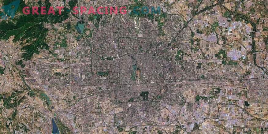
This particular day was decided to mark a photograph of the satellite Sentinel-2, which recorded the capital of China, Beijing. It is considered one of the most densely populated cities in the world (21 million people). However, on New Year's Eve, millions of Chinese people go from large cities to their families to spend their holidays in the family circle. This event is considered a large-scale annual migration. Beijing is located in the north-east of China. It lies on a plain and is surrounded by mountains. From space it seems that the city is divided into many sections, which confirms the antiquity of its creation. The modern form of Beijing appeared during the Ming dynasty (1368-1644). The project was based on the idea that the city should be square and cover 10 main routes.
This image details most of the city, which allows you to even see the famous local attractions. For example, in the center is the Forbidden City.


