Using the complete set of information from Cassini, the scientists created a new large-scale topographic map of Titan. It will allow you to take a fresh look at fluid flows and terrain.
The map combines all of Titan’s topography data from several sources. Only 9% of the satellite was observed at a high resolution, 25-30% at a lower resolution, and the rest was displayed using an interpolation algorithm and a global minimization process to reduce errors that occur during the placement of the spacecraft.
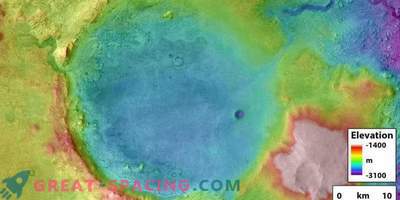
The map displayed several new features on Titan, including mountains, whose height does not exceed 700 m. A global overview of the heights and minima of the topography is also guaranteed, which allowed us to find two depressions in the equatorial region. These can be ancient dry seas or cryovolcanoes.
Also, scientists noted that the moon was more flat (flattened) than previously thought. The map is also useful for modeling the climate of Titan, studying the form and gravity, as well as testing internal models.
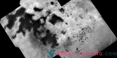
A detailed analysis of the terrain on the map helped to draw important conclusions. Three seas have a common equipotential surface, that is, they form sea level, as terrestrial oceans do. It is possible that a stream passes through the surface layer between the seas, or that the channels between them pass a sufficient amount of fluid, or the oceans are located on the same level. The hypothesis that lakes come into contact with each other through the subsoil was confirmed. Scientists measured the elevation of lakes filled with liquid, as well as dry, and found that the lakes are hundreds of meters above sea level, and the empty ones are at higher levels than the filled ones.
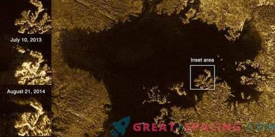
Also noticed that most of the lakes are in sharp recesses, as if these holes were cut. Such lakes are surrounded by ridges, whose height reaches hundreds of meters in some places.
It seems that the lakes formed according to the principle of the Earth, like the Florida Everglades, where the main material dissolves and the surface collapses, forming holes in the ground. The shape of the lakes indicates the process of uniform separation of the slope, where the boundaries of the lakes each time expand by a constant value. The largest lake in the south resembles a series of tiny empty lakes merging into a single formation.
Understanding the processes of formation of lakes will allow to understand the evolution of the polar basins of Titan.


